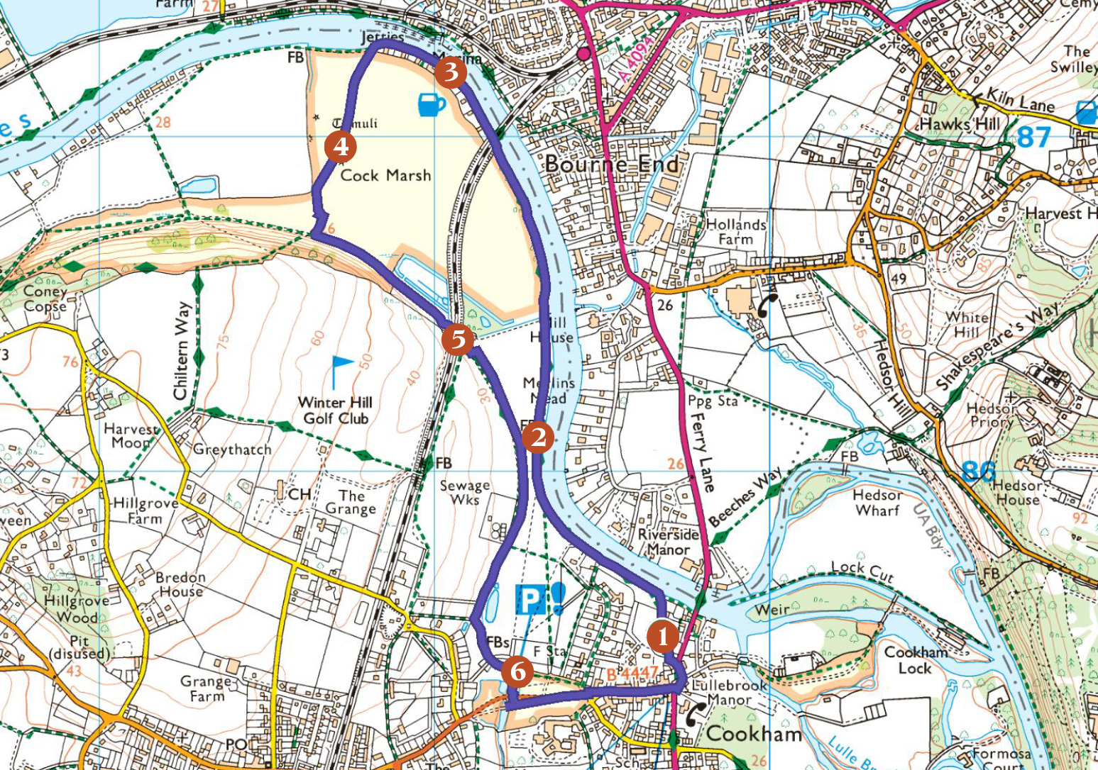

Map © Crown copyright Ordnance Survey. All rights reserved.
Trail Distance 5.4km (3.36 miles)
Trail Point 1
Start by the church tower of Holy Trinity Church, a short walk from the High Street.
The present 12th-century church stands above earlier medieval churches and the undulations of the ground around the churchyard may be evidence of even earlier times – Bronze Age barrows dating back to 1500 BC. The local geography and the geology underlying it explains much of our history. This was a piece of land that doesn’t flood, an “island” of gravel above the shifting alluvial river valley. This provided a place to live and to grow crops, and to celebrate and perform the rituals of life and death. The slow growth of lichens on the gravestones around you are reminders of deep natural time as well as human memory, reflecting layers of occupation stretching back to Mesolithic hunter-gatherers who followed red deer through the Thames Valley and used the river for food and movement.
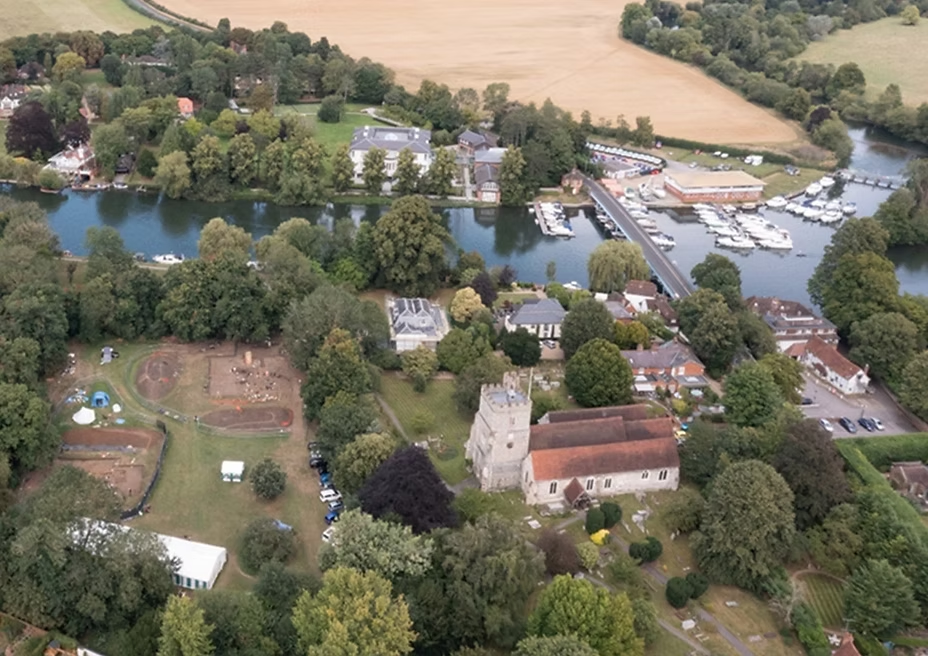
Behind you, behind the hedge to the west of the church lay Cookham Abbey, a royal monastic settlement active around 1,200 years ago. More than a religious centre, it was an economic and administrative hub controlling estates across east Berkshire and south Buckinghamshire. Under Abbess Cynethryth, widow of King Offa of Mercia, it occupied a key position on the Thames trade route between Mercia and London. Archaeological excavations have revealed timber halls, a watermill, a leat, and a Christian cemetery, showing both wealth and evidence of care for the sick and injured.
Walk towards the river over Bell Rope Meadow (with an information board) and walk along the towpath upstream away from Cookham Bridge to your right (the subject of a noted Stanley Spencer painting).
Trail Point 2
On the river bank by the Marsh Meadow information board
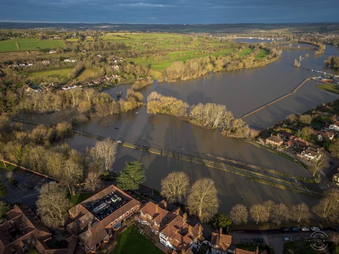
The trail then follows the Thames. A very different river flowed here in earlier times spread across a broad floodplain in many channels around gravel islands, bounded by the higher ground of Bourne End and Winter Hill. Until some 450,000 years ago the Thames flowed north of the Chiltern Hills and entered the North Sea near Ipswich. Glaciation then blocked this route and eventually forced the course of the river through the Chilterns at Goring. The river course we have today was finally settled as the last Ice Age ended roughly 11,000 years ago.
The Cookham Dagger
The name Thames has been with us for more than 2000 years. When the Roman Empire annexed Britannia in the first century AD, the inhabitants spoke a Celtic language. Their name for the river was Tems or Tamessa, from a proto-Celtic root meaning dark or flowing. The Romans simply ‘latinised’ this to create Tamesis.
Rivers for much of history were both practical and sacred: Bronze Age people deposited weapons, jewellery, and human remains in the water as ritual offerings. Near where you are standing a Late Bronze Age sword was recovered by Victorian archaeologists. A Middle Bronze Age bronze spearhead was dredged from the river near Marlow. The river also supported farming, hay meadows, fish, birds, mammals, and rich wetland habitats, much of it now diminished by drainage, pollution, and habitat loss.
Continue along the river bank onto Little Cock Marsh, owned by the National Trust, and part of the extensive area of common land in and around Cookham. At the railway bridge continue along the towpath and pass (or not!) the Bounty pub on your left. Keep on to reach a path heading left across Cock Marsh.
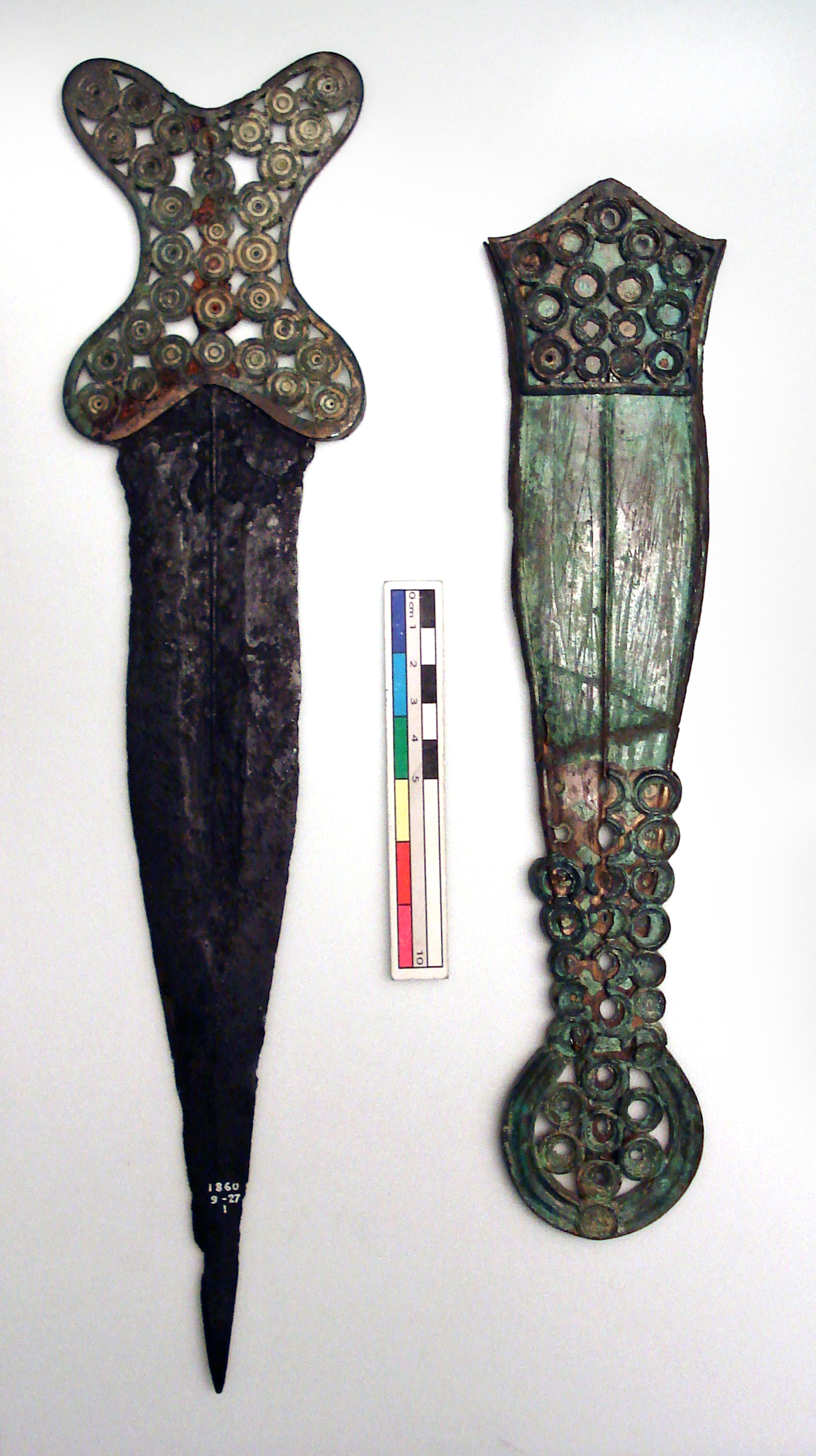
Image © The Trustees of the British Museum. Licensed under CC BY-NC-SA 4.0.
Trail Point 3
After the Bounty
All this area to the south of the river is floodplain grassland. In the past this would have been kept as meadows to provide hay for winter feed, mainly for cattle. The higher ground further back from the river towards Cookham Dean and Winter Hill will have provided crops in the Spring and Summer and grazing for livestock after the crops had been cut.
Look towards the Cock Marsh chalk escarpment to see a white chalk path winding up it, one of the traditional transhumance tracks used for the seasonal movement of livestock between a valley and the higher land.
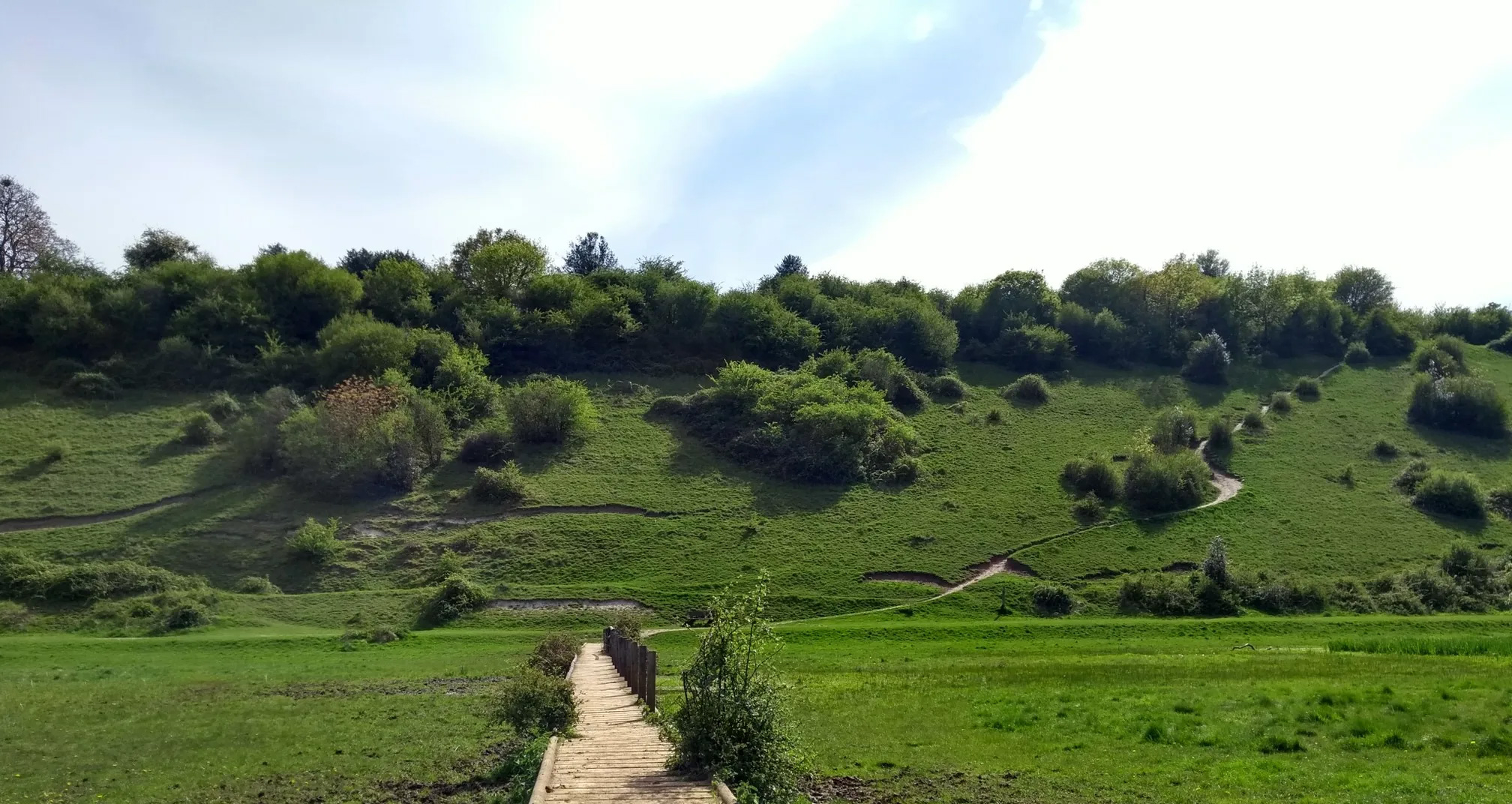
Cock Marsh Chalk escarpment
The floodplain landscape was once more widely tree-covered and the meadows were rich with wild flowers before we lost more than 95% of these habitats in the late 20th century. Away from the river, woodland will have dominated, remnants of which can be seen in the woods of Cookham Dean.
Looking towards the escarpment the land in between looks flat. But, if you can, crouch down, to ground level and, to the right of the escarpment, you can see the bumps in the land and a slight rise in the land towards the west. This is the edge of another gravel island, and the site of Bronze Age tumuli.
Walk along the path towards the tumuli.
Trail Point 4
At the Cock Marsh tumuli
There are four recorded bowl barrows (burial mounds), with three clearly visible barrows and others that have been mostly flattened over the centuries. Walk up to the barrows and get a sense of how high they are from the river level.
They were excavated in the 1870s by Victorian amateur archaeologists who found cremation burials including a female adult and a child, and various pottery fragments and tools. There was also an Anglo-Saxon burial with grave goods in one of the barrows.
Imagine the landscape millennia ago, with the water frequently lapping around the higher gravel bank. Picture too the ceremonies that accompanied the last journey of the dead. The barrows were both memorials and also statements of land ownership and control.
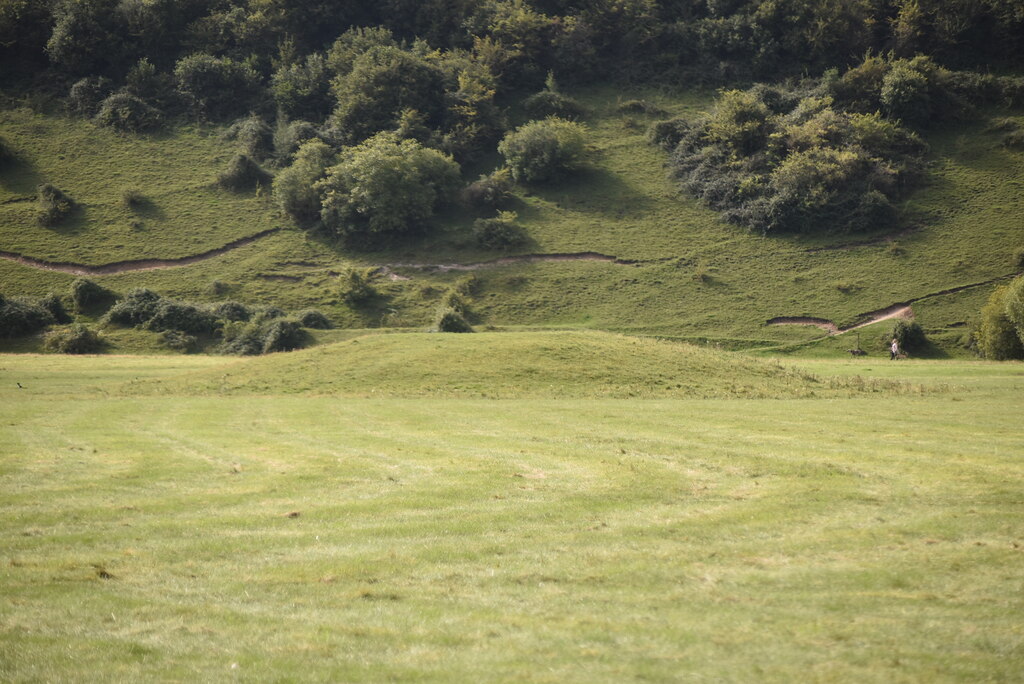
Bronze Age tumuli. Credit: N Chadwick
Walk to the path at the foot of the escarpment. You will cross over some lower land, the remains of one of the old river channels. Further along to the right is a series of ponds, including one recognised as of high botanic quality and of the country’s flagship ponds.
Now follow the path left along the foot of the Cock Marsh escarpment, go under the railway bridge and then take the path with the golf course on your right to reach Cookham Moor.
Walk to the path at the foot of the escarpment. You will cross over some lower land, the remains of one of the old river channels. Further along to the right is a series of ponds, including one recognised as of high botanic quality and of the country’s flagship ponds.
Now follow the path left along the foot of the Cock Marsh escarpment, go under the railway bridge and then take the path with the golf course on your right to reach Cookham Moor.
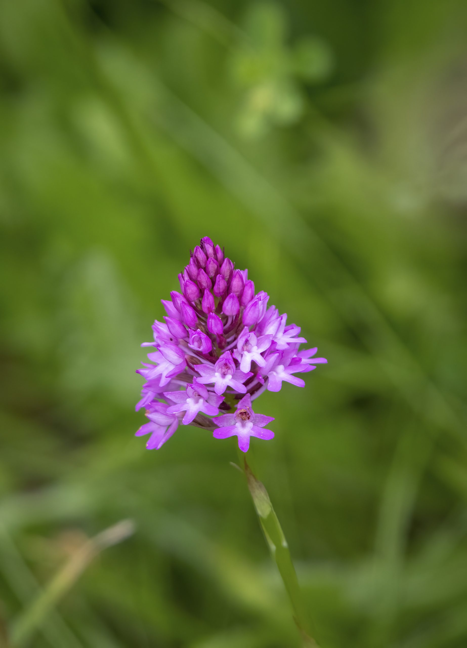
Pyramidal Orchid found on the chalk escarpment
Trail Point 5
Under the Bridge
You pass under the Maidenhead to Marlow railway, once one of the main routes to the Midlands from London Paddington, until the Bourne End to High Wycombe stretch was closed in the early 1970s. During its construction in 1854 six Anglo-Saxon burials were uncovered in the higher ground above you. Unlike the Cock Marsh barrow burials these were cut directly into gravel. Dated to the middle Anglo-Saxon period (late 5th to 7th century) they may been linked to a lost settlement at Cookham Rise. Some of the graves contained weapons, suggesting high-status individuals.
The stream which your path now follows is recent. Look out for evidence of the Water Voles, a local resident for millennia and reintroduced in the early 2020s.

Water Voles reintroduced in the early 2020s
Trail Point 6
Cookham Moor
When you reach the car park you are on Cookham Moor, another of the areas of common land owned by the National Trust. These manorial commons go back to the Medieval period that is conventionally dated to the Norman Conquest from 1066 but may predate that. Commoners were small (mostly subsistence) farmers who held rights such as grazing animals and gathering wood. In Cookham the residents fought the efforts of bigger landowners to enclose the land, one of the few communities to do this successfully. Whilst some land was eventually enclosed nearly 900 acres remained as common land which eventually passed to the National Trust in the 1930s. Where you are standing by the car park still floods every few years, returning Cookham to its historic identity as an island.
You can return to your starting point by the church by walking along the High Street and turning left at the end. Or walk down Berries Road by the Crown Inn until you reach the river and retrace your steps to the church.